Google Transit Maps + WiFi
Posted by Sam Churchill on April 11th, 2008 Google Transit covers some 23 U.S. cities and the national mass transit system of Japan and bigger cities in Australia and Europe. Go to Google Maps. Type in a query for directions.
If your results include a button for “Take Public Transit,” Google Transit will spell out directions to the closest station or bus stop, including schedule information.
In the United States. Google Transit Maps are available for;
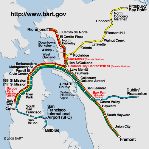
- Bay Area, CA BART, Caltrain, VTA
- Burbank, CA Burbank Bus
- Humboldt County, CA Various
- Modoc County, CA Sage Stage
- Orange County, CA OCTA
- Sacramento, CA Regional Transit
- San Diego, CA MTS
- Thousand Oaks, CA Thousand Oaks Transit
- Grand Junction, CO Grand Valley Transit
- Tampa, FL HART
- Honolulu, HI TheBus
- Chicago, IL CTA
- Pioneer Valley, MA PVTA
- Detroit, MI SMART
- Duluth, MN Duluth Transit
- Statewide, NJ NJ TRANSIT - trains only
- Las Vegas, NV Monorail
- Reno, NV RTC RIDE
- Eugene, OR Lane Transit District
- Portland, OR TriMet
- Pittsburgh, PA Port Authority
- Austin, TX Capital Metro
- Dallas, TX DART
- Seattle, WA King County Metro
You can also track the Olympic torch on the way to Beijing.
Outfitting a bus with wireless capability costs about $1,000 to $2,000, reports USA Today.
Here are some transit agencies in the United States adopting Wi-Fi.
- The Massachusetts Bay Transportation Authority added it to its 45-mile rail line between Worchester and Boston in January. Deputy Chief of Staff Kris Erickson said it’s “probably the most well-received enhancement that we’ve ever done.”
- New York City’s Metropolitan Transportation Authority announced an agreement last September to wire the city’s 277 subway stations in the next six years. The first should be wired in two years.
- Seattle’s King County says wiring and installation on each bus cost $1,000, according to Mike Berman of the county’s Metro Transit Division.
- Microsoft’s free Connector, a regional bus system for employees, which launched in September, will add new routes and double capacity to 4,600 seats a day.

- The Utah Transit Authority began offering Internet service on 60 of its buses in January.
- San Francisco Transit Authority unveiled the “Connected Bus in February.
- BART’s entire 103-mile rail system is likely to get unwired by WiFi Rail which is also in talks with other large urban commuter rail systems, including those in Chicago, Dallas, Atlanta and Los Angeles.
- Cincinnati started its three-month wireless pilot program in March on a single route.
In Cincinnati, the bus system, worked with Dayton, Ohio-based HarborLink, paying $1,500 per bus for installation and nothing for the monthly service. The Utah Transit Authority reports the number of unique wireless users on its buses increased from about 500 in January’s start-up to 2,500 by the end of March.
source : dailywireless.org


No comments:
Post a Comment